
Ventnor map
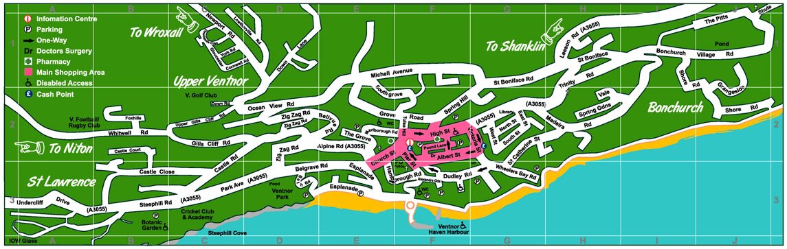
The smartest visitors around town carry one of these Ventnor maps – they’re available neatly folded up, into a suitably portable format, from Ventnor’s shops, the main ferry terminals and other venues around the island. We hope you’ll agree that they’re pretty darn handy. This map will help you find your way and plan your day.
You’re probably thinking, well, a high quality map like this, with all those pretty colours, must cost £3 or maybe £4… but guess what – it’s completely free! Plus as well as the free paper map, you can use the online version above. If you click on the image it will grow, as if by magic, in front of your very eyes. One day we’ll produce an interactive map for you too *wild cheering fills the streets of Ventnor and dancing girls do the can-can down the High Street.*
That’s if Google doesn’t beat us to it.

The map is a gift from the Ventnor Business Association. It’s our way of saying we love you, hope you love us too!